In May 2020, a consortium of resource professionals, tournament fisherman, recreational anglers, and community members was formed to develop a long-term fisheries habitat development plan for Mark Twain Lake. The members assessed current lake conditions, existing habitat structure, capabilities of independent entities, available resources, existing facilities, and the alignment of long-term goals.
Subsequent communication and collaboration yielded an initial five year management plan to establish artificial fisheries habitat at areas deemed imperative for implementation. The corporate goal of the plan is to establish new artificial habitat replacing the natural habitat which has deteriorated through the natural maturation process, or through the authorized operational requirements imposed upon the reservoir.
Choose a location below to view the map and a list of the coordinates of the current fish habitat structures:
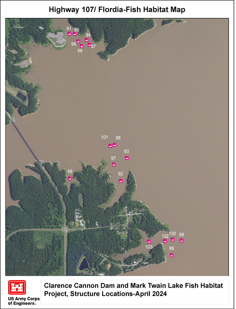
Hwy. 107

Indian Creek Route N

North Fork Three Fingers

Route U
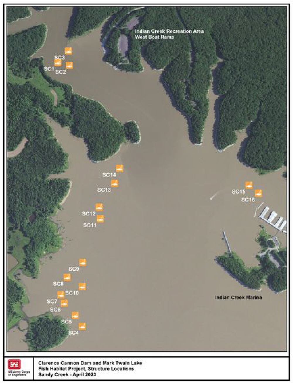
Sandy Creek

Shell Branch
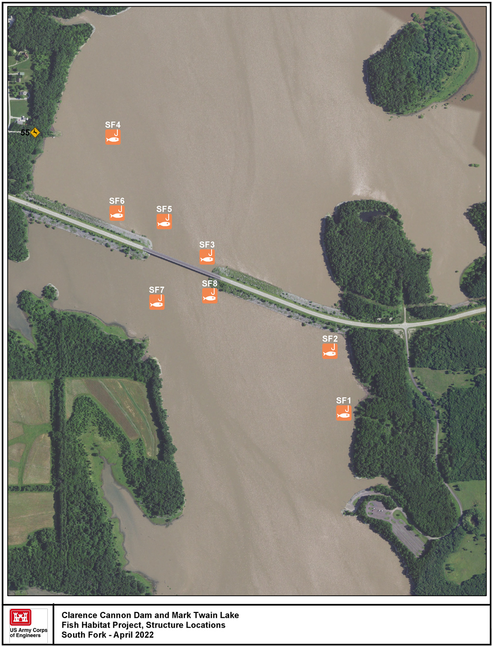
South Fork
